This report mentions our town specifically. . . . .
I shall have to rethink my departure time homeward bound. . . .I want to arrive before Earl attacks us. ;-)
A Road Trip is looming. . . ..soon.
ciao ciao. . .
justin
Local Radar Map
What's This?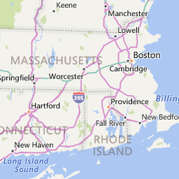


Updated 2 Sept 2010 12:30 pm Local Time
Issued by The National Weather Service
Boston, MA
11:59 am EDT, Thu., Sep. 2, 2010
Boston, MA
11:59 am EDT, Thu., Sep. 2, 2010
... HURRICANE WARNING IN EFFECT...
... NEW INFORMATION... A HURRICANE WARNING HAS NOW BEEN ISSUED. A MORE DETAILED STATEMENT WILL FOLLOW SHORTLY.
More Information
... HURRICANE EARL APPROACHING SOUTHEAST NEW ENGLAND...
.AREAS AFFECTED... THIS LOCAL STATEMENT PROVIDES IMPORTANT INFORMATION AND RECOMMENDED ACTIONS FOR PEOPLE AND MARINE INTERESTS IN SELECT LOCATIONS AND COASTAL WATERS OF SOUTHERN NEW ENGLAND AND MASSACHUSETTS AND RHODE ISLAND COASTAL WATERS.
.WATCHES/WARNINGS... A HURRICANE WARNING IS IN EFFECT FOR THE FOLLOWING LOCATIONS... EASTERN PLYMOUTH MA... SOUTHERN BRISTOL MA... SOUTHERN PLYMOUTH MA... BARNSTABLE MA... DUKES MA AND NANTUCKET MA.
FOR MARINE INTERESTS... A HURRICANE WARNING IS IN EFFECT FOR PORTIONS OF MASSACHUSETTS AND RHODE ISLAND.
A TROPICAL STORM WARNING IS IN EFFECT FOR THE FOLLOWING LOCATIONS... SOUTHEAST PROVIDENCE RI... EASTERN KENT RI... BRISTOL RI... WASHINGTON RI... NEWPORT RI AND BLOCK ISLAND RI.
A TROPICAL STORM WIND WARNING IS IN EFFECT FOR THE FOLLOWING LOCATIONS... NORTHERN BRISTOL MA... WESTERN PLYMOUTH MA.
FOR MARINE INTERESTS... A TROPICAL STORM WARNING IS IN EFFECT FOR PORTIONS OF MASSACHUSETTS AND RHODE ISLAND.
A TROPICAL STORM WATCH CONTINUES FOR THE FOLLOWING LOCATIONS... EASTERN ESSEX MA... SUFFOLK MA AND EASTERN NORFOLK MA.
FOR MARINE INTERESTS... A TROPICAL STORM WATCH CONTINUES FOR PORTIONS OF MASSACHUSETTS AND RHODE ISLAND.
.STORM INFORMATION... AT 11 AM EDT... THE CENTER OF HURRICANE EARL WAS LOCATED NEAR LATITUDE 30.9N... LONGITUDE 74.8W. THIS WAS ABOUT 760 MILES SOUTH-SOUTHWEST OF NANTUCKET MA. STORM MOTION WAS NORTH OR 355 DEGREES AT 18 MPH. STORM INTENSITY WAS 140 MPH.
.SITUATION OVERVIEW... HURRICANE EARL IS A DANGEROUS CATEGORY 4 HURRICANE AND IS MOVING TOWARD THE NORTH CAROLINA COAST. EARL IS EXPECTED TO TURN NORTH LATE TODAY THEN NORTHEAST FRIDAY TOWARD SOUTHEAST NEW ENGLAND. THE LATEST TRACK PROJECTION HAS SHIFTED SLIGHTLY TO THE WEST AND EARL IS NOW EXPECTED TO TRACK WITHIN 30 MILES SOUTH OF NANTUCKET FRIDAY NIGHT.
EARL WILL BEGIN TO WEAKEN THURSDAY NIGHT AND FRIDAY AS IT MOVES OVER COOLER WATERS BUT MAY STILL BE A CATEGORY 2 HURRICANE AS IT MAKES ITS CLOSEST APPROACH TO NANTUCKET FRIDAY NIGHT.
IT IS TOO EARLY TO PROVIDE EXACT WIND AND SURGE FORECAST VALUES FOR SPECIFIC LOCATIONS. A GENERAL CONCERN SHOULD BE FOR THE POSSIBILITY OF AT LEAST EXTENSIVE DAMAGE SOMEWHERE WITHIN SOUTHERN NEW ENGLAND.
.PRECAUTIONARY/PREPAREDNESS ACTIONS... PRECAUTIONARY/PREPAREDNESS ACTIONS...
FOR THOSE UNDER A WARNING... NOW IS THE TIME TO RUSH TO COMPLETION PREPARATIONS FOR THE PROTECTION OF LIFE AND PROPERTY. EVACUATE IF DIRECTED TO DO SO BY LOCAL OFFICIALS... OR IF YOUR HOME IS VULNERABLE TO HIGH WINDS OR FLOODING. FOR INTERESTS AT PORTS... DOCKS... AND MARINAS... URGENTLY COMPLETE PRESCRIBED PREPARATIONS ACCORDING TO YOUR EMERGENCY OPERATIONS PLAN FOR TROPICAL CYCLONES. IF YOU LIVE ON A BOAT... MAKE FINAL PREPARATIONS FOR SECURING YOUR CRAFT BEFORE LEAVING IT. BE SURE TO ACCOUNT FOR THE POSSIBLE CLOSURE OF BRIDGES AND CAUSEWAYS. REGARDING ANY COASTAL WATERS UNDER A WARNING... SMALL CRAFT SHOULD REMAIN IN PORT AND WELL SECURED. FOR THOSE UNDER A WATCH... CONTINUE WITH YOUR PREPARATIONS AND LISTEN FOR POSSIBLE WARNINGS. REGARDING ANY COASTAL WATERS UNDER A WATCH... SMALL CRAFT SHOULD RETURN TO PORT OR SEEK SAFE HARBOR. DETERMINE THE BEST STRATEGY FOR SECURING YOUR CRAFT.
More Weather Alerts for Provincetown, MA
11 comments:
What hell is on the mainland? I am a Cape Caawwd boyo. . .my loves and my heart are there! Silly COOPs. .. LOL(K)
NO! PRIME RIB!!! ;-)
Check the noon report, posted. The storm will be gone by early Sat a.m.
That leaves me Sat. Sun. Mon of brilliant "end of summer" sunshine!
Besides, all the rest of the family is already at HOME-base. . including Mme Bouvier! Bro & Sis and their spouses and the KIDS!
PLUS PLUS. . Peter is there! And does not have 4a.m. opener shifts all weekend. hehehe. . .hola!Ole!
PLUS PLUS PLUS I am leaving in a couple hours headed south. If the world evacuates OFF to the mainland I will Rte 6 east all to myself. BUT NO ONE is evacuating.
There'll be some "swells" in the Habour. . I doubt the catamaran Salacia will be making the skim from Boston on choppy seas with high waves. . . but, babe, LIFE will happen. .. LIFE will go on. . it always has and and will. . . .
world without end. Amen.
Let all the faithful say: AaahMen!
hahahaa
sea yas. . .
justin
it's weird, since i was just on the cape only a month ago. And i can understand wanting to be home, but with the excitement comes danger.
Stay safe, Justin.
Yes Justin the entire east coast of North America is watching this one! We are ready here as Earl is supposed to hit landfall somewhere in the Maritimes.
Good luck in getting back safely Justin. And have a great weekend on the Cape.
Jim
Have fun. Justi (you too Peter)! Please know that I will be praying for your safety... As well as the safety of your family and mine who live on the Mainland in Massachusetts... but not too far from the Cape.
I'm about as far away from Earl as anyone can get, and that's exactly where I wanna be.
Don't hang your washing on the line just yet, Justino. As Jimm says, stay safe.
Actually, I'm not sure what it takes to stay safe during a hurricane, but if it means wearing a condom, then wear one.
While you may enjoy this sort of thing, we just had a tornado here last week. And it makes me glad that 3 weeks ago, I canceled a cruise from NYC skipping up the coast to Boston and eventually Halifax and back that was supposed to leave Friday afternoon.
Instead we opted for a camping trip with the dog on the west coast of Michigan.
We are sending you a cold front to help push the hurricane off shore right away. I hope it helps. Either way, be safe. And enjoy the weekend after, provided there isn't a lot of damage.
Thanks, JIM. . .I am already home! hehe. . ..waste no time doing Road Trip. . .heheh No problems at all...sun was shining. . .much of the time.
Nice to be here. . .we are ready. . all depends, for us, the force of the winds. . . .;-)
Goo luck to you guys in the Maritimes . . .sounds like you might get is head on!
Good luck!
justin
Thanks, Gary. You mean a "body sock"? hahahahahahahahaaa
Thanks, Erich, for all your great thoughts and wishes. Will ;let you know what happens. . . LOL
justi
OK COOPs. . .not bad yet here. . .i wonder. . .I am glad I followed my fancy and came home early. . .no prob anywhere cuz the old Earl is still waaaay South of us. . Glad to be here. We had a "family good time" this evening. . . .all of us.
Everyone seems tucked into bed. . Dad and I are still prowling around.
We were just out to check on a few things. . .all is well, battened down. . LOL It may be low 70*f / [21.1111 c. ] humidity is 88%. . .feels like walking into a sauna. .HOT.
Wind hasn't picked up any. . not noticeable. If we are hit it will be later afternoon, early evening and then it shuffles off to Nova Scotia and the Maritimes. . .
Very glad to be at home with family for a wonderful weekend.
G'Night ALL. . Sweet dreams. . .
peter and justin ;-)
Post a Comment